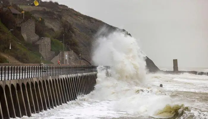
The UK and the Republic of Ireland are bracing for Storm Darragh, which is set to bring damaging winds of up to 90mph. The storm has prompted the Met Office to issue a severe red weather warning for parts of the UK. The warning highlights a “danger to life” due to high winds, with flying debris and fallen trees posing significant risks.
The red weather warning covers coastal areas of Wales and the South West of England, including Cardiff, Bristol, and Devon. The warning is in effect from 3am to 11am on Saturday, with the strongest winds expected to begin easing by late morning. The storm is expected to disrupt travel and cause significant damage to property and infrastructure.
Risk of Disruption and Damage
The Met Office has warned that the storm could cause “substantial disruption” to travel, energy supplies, and possibly widespread property damage. The storm’s winds could throw large waves and beach debris onto coastal roads and seafronts. This, combined with falling trees, could create dangerous conditions for both pedestrians and drivers.
Over three million people in areas covered by the red weather warning received text alerts from the Cabinet Office at 6.45pm. The alerts provided important safety information on how to prepare for the storm. This marked the largest use of the alert system outside of test scenarios.
Impact on Ireland
A separate red wind warning has been issued by Ireland’s Met Éireann. This warning covers coastal areas, including Mayo, Galway, Donegal, Leitrim, and Sligo. The warning is in effect from Friday evening until early Saturday morning. The storm is expected to move across the Irish Sea, bringing extreme winds during the early hours of Saturday.
High Winds Across Both Regions
Storm Darragh is set to bring gusts of 90mph or more over coasts and hills of west and south Wales, with the strongest winds likely to funnel through the Bristol Channel. The storm will also bring very large waves to exposed beaches. Although the strongest winds will ease by late morning, the situation will remain dangerous, with amber wind warnings in place until the evening.
Warnings for Rain and Snow
In addition to the strong winds, the storm is expected to bring heavy rain and snow to parts of both the UK and Ireland. Forecasters have issued additional warnings for rain and flooding. Some areas may experience localised flooding, especially as the storm moves eastward.
Stay Safe and Prepare
The public has been urged to remain vigilant and prepare for the storm’s impact. People in affected areas should avoid unnecessary travel, especially during the early hours when the storm is expected to reach its peak. Local authorities are working to ensure that emergency services are ready for any potential incidents caused by the storm.
Follow Day News on Google News, Instagram, YouTube, Facebook, Whats App, and TikTok for latest updates


