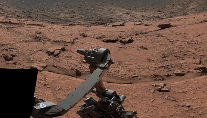
NASA has released breathtaking Mars images, offering an unprecedented look at the planet’s surface. Captured by advanced cameras on rovers and orbiters, these high-resolution panoramas showcase Mars’ rugged mountains, deep valleys, and evidence of ancient water flows. These images provide both scientists and space enthusiasts with a detailed glimpse of the Red Planet’s geological history.
A New View of Mars
The panoramic images, stitched together from hundreds of individual photos, reveal the vast and varied landscapes of Mars. From towering cliffs to cratered plains, each image highlights the planet’s unique features. NASA’s Perseverance and Curiosity rovers, along with orbiters like the Mars Reconnaissance Orbiter, captured these detailed shots, helping scientists uncover Mars’ environmental past.
“These panoramas give us a deeper appreciation of Mars’ geology and evolution,” said Dr. Lori Glaze, director of NASA’s Planetary Science Division. “They guide us in selecting areas for future exploration and potential human missions.”
Read: AMD Radeon RX 9070 XT: A Game-Changer for 4K Gaming
Key Highlights from Mars’ Surface
The newly released images feature some of Mars’ most significant landmarks:
- Jezero Crater: The landing site of the Perseverance Rover, once an ancient lakebed that may have supported microbial life.
- Valles Marineris: A canyon system ten times longer than the Grand Canyon, revealing layers of Mars’ geological history.
- Olympus Mons: The largest volcano in the solar system, standing over 13 miles (22 km) high.
- Gale Crater: Explored by the Curiosity Rover, this area contains sedimentary rock layers that hold clues about the planet’s climate history.
Why These Images Matter
Beyond their stunning visuals, these images provide critical data for future Mars missions. By analyzing rock formations, erosion patterns, and dust movement, scientists can determine potential landing sites for both robotic and human exploration.
NASA is using this information to prepare for upcoming missions, including the Mars Sample Return program, which aims to bring Martian soil and rock samples back to Earth for detailed study. These efforts could help answer one of humanity’s biggest questions: Did Mars ever support life?
Preparing for Human Missions
NASA, along with international space agencies like ESA (European Space Agency), is actively planning human missions to Mars in the 2030s. However the newly released images help scientists identify safe landing zones, resource-rich locations, and potential sites for future bases.
Mars exploration continues to push the boundaries of human knowledge. These images not only reveal the Red Planet’s secrets but also bring us closer to the day when astronauts will set foot on its surface. As technology advances, each mission takes us one step closer to understanding Mars’ past—and its potential for sustaining life.
Follow us on Google News, Instagram, YouTube, Facebook,Whats App, and TikTok for latest updates