The recent Pakistan floods have left thousands questioning whether India worsened the disaster by releasing excess water from its dams. Since the suspension of the Indus Waters Treaty (IWT), New Delhi no longer provides detailed water data, weakening the early warning system that once allowed Pakistan to prepare. Experts, however, say the situation is complex and shaped more by extreme weather than deliberate intent.
Understanding Dam Water Releases
Dr. Hassaan F. Khan, an urban water expert at Tufts University, explained that dams have two types of gates: regular release gates and spillways. Regular gates are used for agriculture and water supply. Spillways, however, are opened only when dams reach maximum capacity.
“When a dam fills beyond safe limits, water must be released to prevent structural damage,” Dr. Hassaan said. “Otherwise, the dam could collapse. India recently opened spillways because heavy rains filled their reservoirs. Such releases are not unusual.”
Read: Congress Releases First Batch of Jeffrey Epstein Files as Survivors Demand Full Disclosure
Extreme Rainfall Across the Region
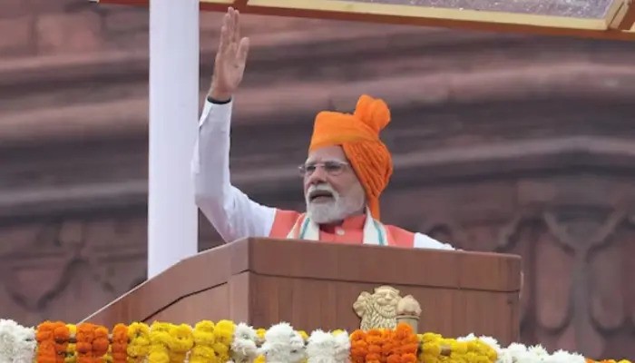
This monsoon season saw record-breaking rains, particularly in Himachal Pradesh. The rainfall increased river flows and forced India to release water into the Sutlej and Ravi rivers. According to Dr. Hassaan, Prime Minister Narendra Modi had previously pledged not to let even a drop of these rivers flow into Pakistan. But when storage becomes impossible, the water must be flushed out.
“These decisions are driven by necessity, not politics,” he added. “There is no evidence of intentional flooding aimed at Pakistan.”
Weakening of the Indus Waters Treaty System
Since India suspended detailed data sharing under the IWT, Pakistan receives only brief notifications through diplomatic channels. Earlier, both sides exchanged real-time data that allowed flood warnings to reach communities in time. Experts argue that the reduced flow of information has left Pakistan vulnerable.
“Now, the early warning system is weaker,” Dr. Hassaan said. “We cannot verify India’s releases directly, and that fuels speculation.”
Natural Hydrology and Seasonal Cycles
Senior researcher Muhammad Umer Karim explained that regional river flows are shaped by both glacier melt and monsoon rains. Water freezes in winter, melts in summer, and joins the monsoon downpour to increase river volumes. Dams store water for irrigation and drinking needs during dry months.
“This year, Indian dams were already overflowing,” Karim said. “Spillways had to be opened, which contributed to flooding in eastern rivers.”
Similar Infrastructure on Both Sides
Environmental lawyer Ahmed Rafay Alam noted that dam infrastructure in both countries is nearly identical. India has major dams on the Jhelum, Beas, and Ravi, while Pakistan relies on Mangla and Tarbela. Both sides store monsoon and glacier water for winter crops.
“These dams were even built by the same American companies,” Alam explained. “Their designs and operations are essentially the same.”
Critical Situation in August
Alam pointed out that three Indian dams—the Pong Dam on the Beas, Bhakra Dam on the Sutlej, and Madhopur Headworks on the Ravi—reached dangerous levels between August 23 and 25. India had no choice but to release water.
“To protect infrastructure, they opened spillways,” Alam said. “Some gates of the Madhopur barrage even collapsed due to water pressure, killing one person. These were controlled releases, not attacks.”
Domestic Political Tensions in India
Alam argued that political rivalries within India also shaped the crisis. While dam operations for power generation are federally managed, irrigation and water supply fall under state governments.
“The Thein Dam on the Ravi is in Punjab state, where Congress is strong,” Alam explained. “The BJP-led federal government failed to share timely warnings. As a result, Indian Punjab suffered major losses. Around 500 villages were submerged, and its government is now demanding an inquiry.”
This, he said, proves that Indian Punjab suffered alongside Pakistan.
Water Releases Travel Through Indian Villages
Experts stressed that floodwaters released in India do not flow straight into Pakistan. Instead, they pass through Indian towns and villages, traveling 100 to 150 kilometers before crossing the border.
“Indian water releases added to Pakistan’s burden,” Alam said, “but they also devastated Indian communities. Both countries faced destruction.”
The Limits of Infrastructure
Dr. Daanish Mustafa, a professor of water resource geography at King’s College London, emphasized that no infrastructure can stop extreme monsoon flows.
“Water release occurs when reservoirs exceed safe design capacity,” he said. “The more rain, the more water. India actually faced greater destruction than Pakistan because the force of the water hit them first.”
A Shared Climate Challenge
The experts agreed that climate change is amplifying extreme rainfall across South Asia. Both India and Pakistan are vulnerable to these climate-driven disasters. Instead of accusations, they said, cooperation is needed to strengthen early warning systems and manage shared rivers.
Follow us on Instagram, YouTube, Facebook,, X and TikTok for latest updates
